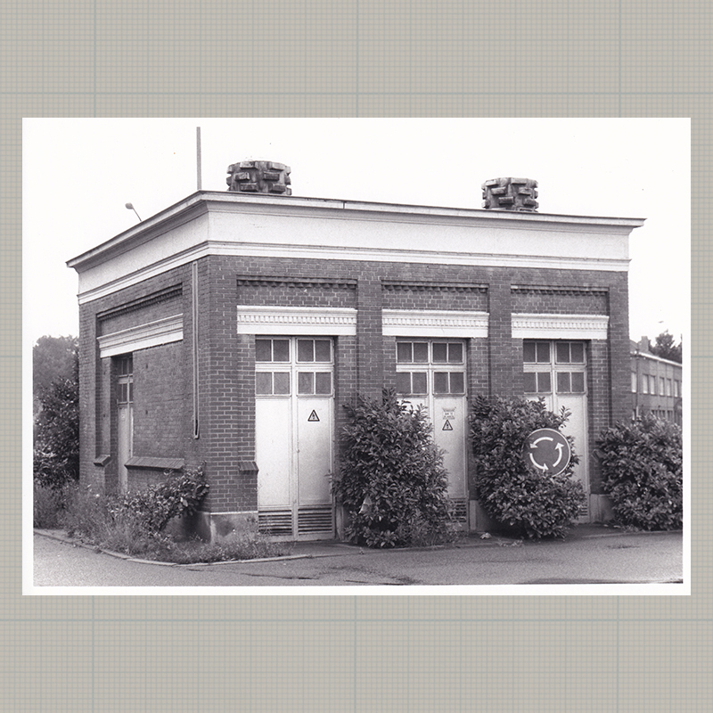
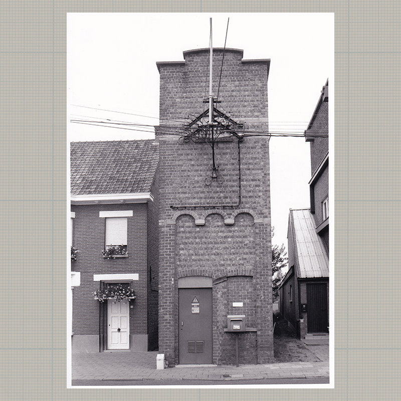
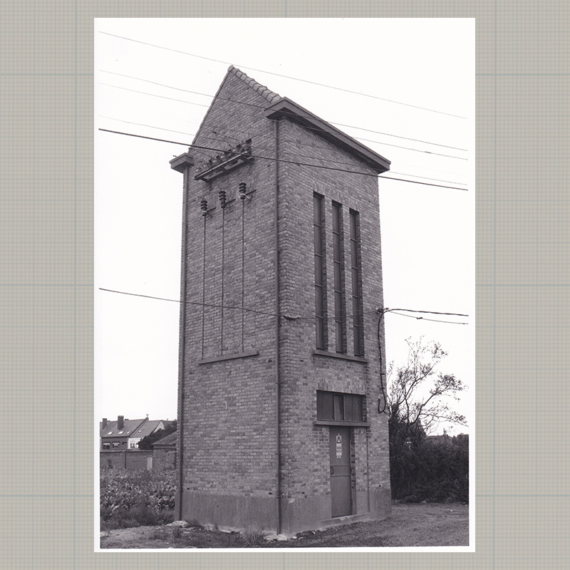
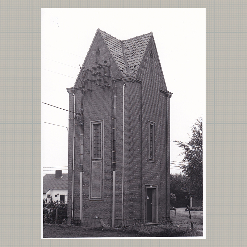
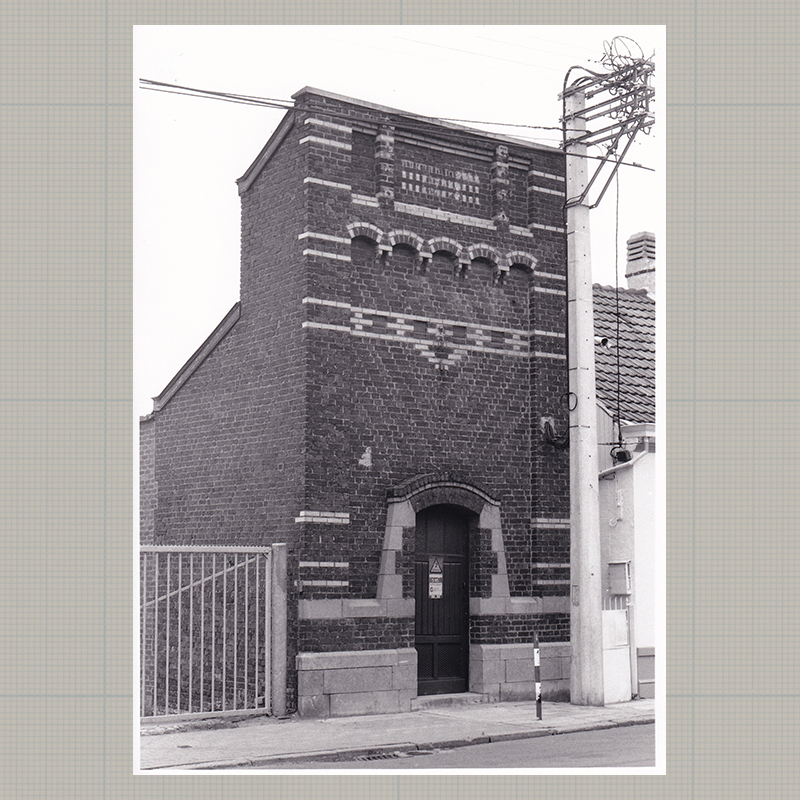
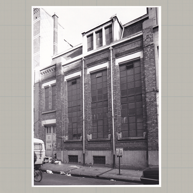
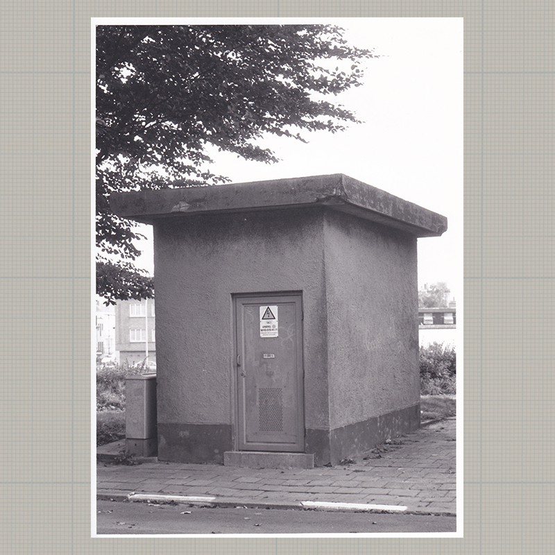
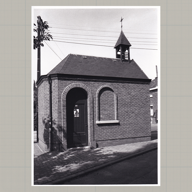
My first series of photos that I made for my dissertation in interior architecture at the Sint-Lukas Institute was indebted to the typologies of Bernd und Hilla Becher. Starting from a particular electric cabin (nr.26 - Herbette) in my neighborhood at Anderlecht, I photographed around 80 electric cabins in Flanders and cataloged them based on style features, technology, region, etc.
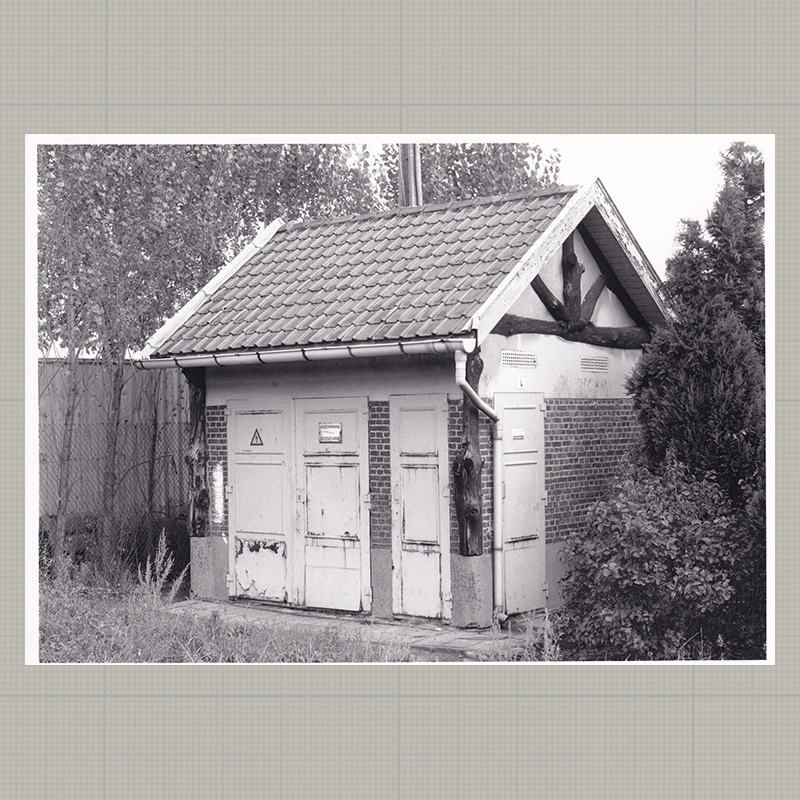
The importance of photographically documenting this cabins cannot be underestimated. In contrast to houses or monuments, electric cabins are seen as technical buildings, which only have a reason to exist as long as they are functional. Moreover, their small size makes them less popular as industrial landmarks, such as water towers or bridges. Therefor they rarely acquire the status of protected heritage.
In collaboration with my late promoter Albert florin, production manager at the power plant of Langerbrugge and co-founder of the photography club Progendis-Electrabel, I cruised several weekends, during the year 1993, collecting and photographing particular electricity distribution cabins across Flanders. Without his knowledge, connections and enthusiasm, the project would be less extensive.
The cabins are numbered, according the original publication of 1993. A re-inventory in 2020 showed that a quarter of the 80 cabins have since 1993 disappeared or been replaced by a prefab model.
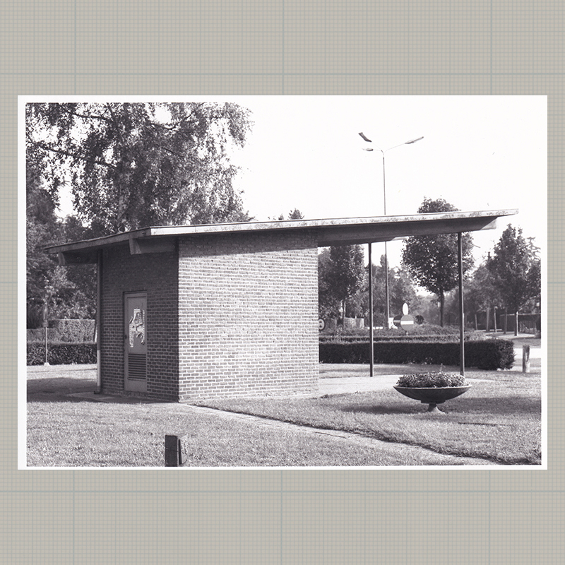
Series taken on AGFA Scala 200x b&w | © Peter Chinitor | Zazourian 1993
-
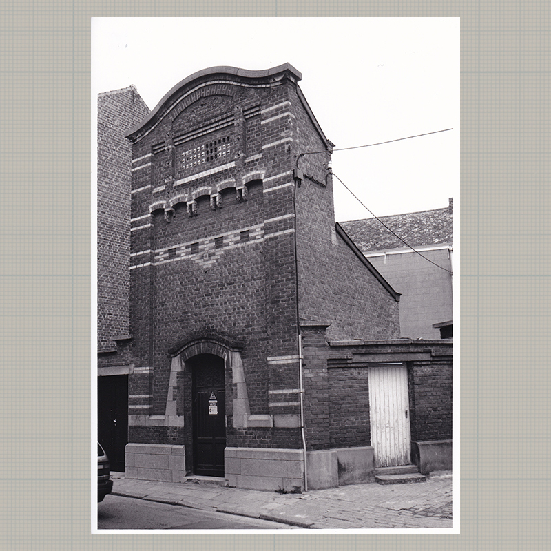
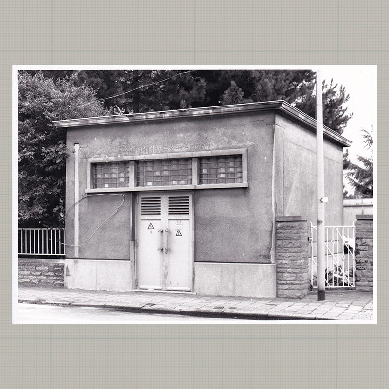
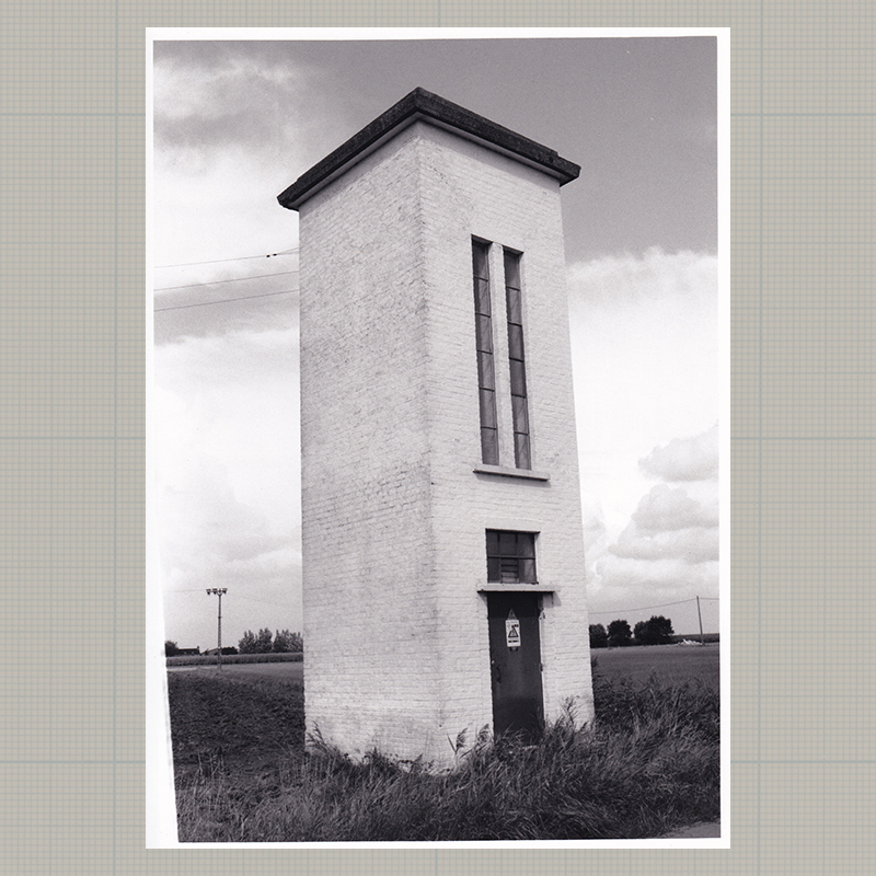
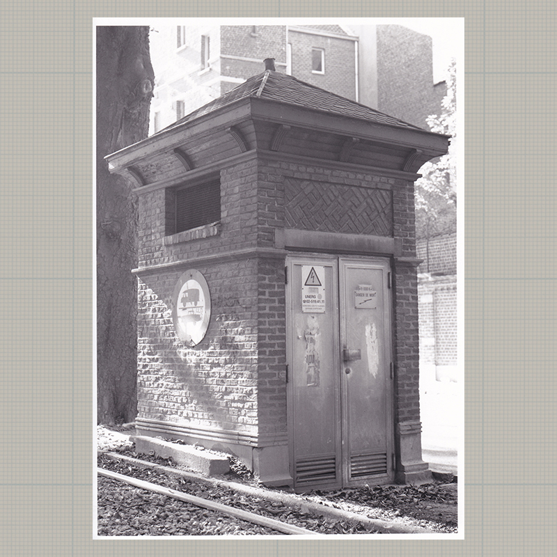
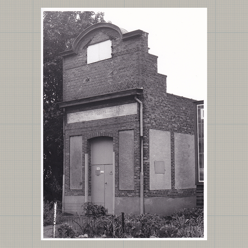
01 | Ukkel | 50°48'48.8" N 4°20'24.5"E
-
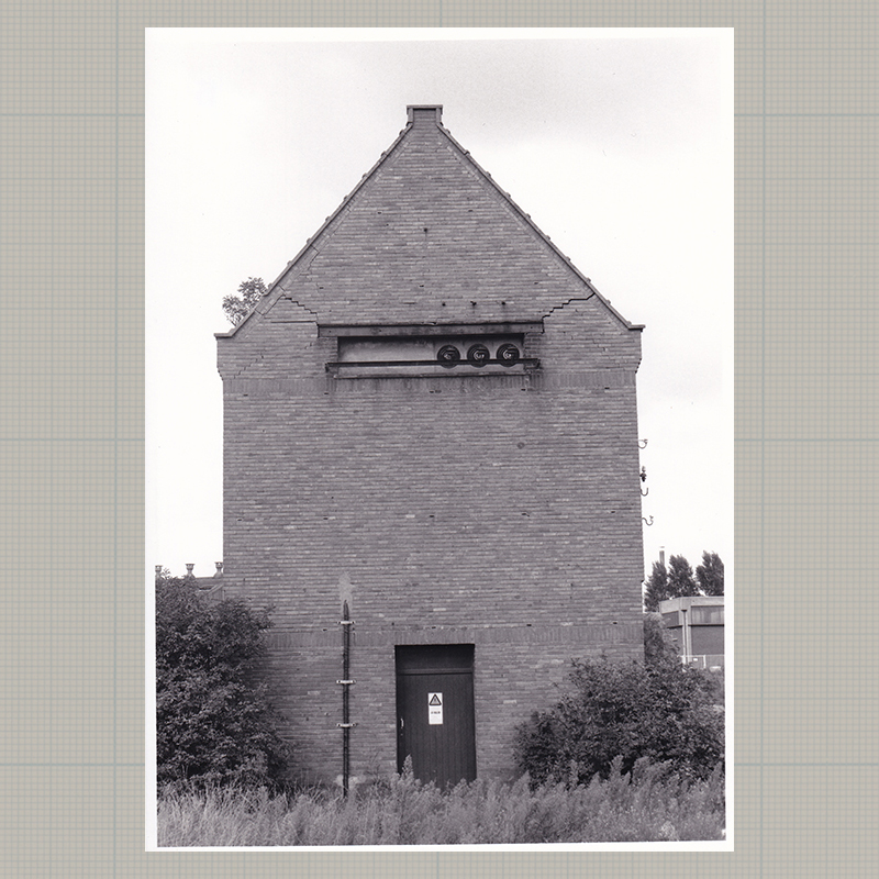
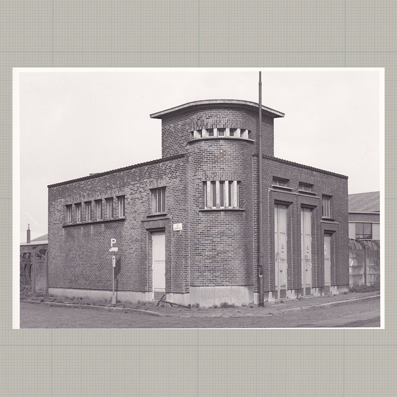
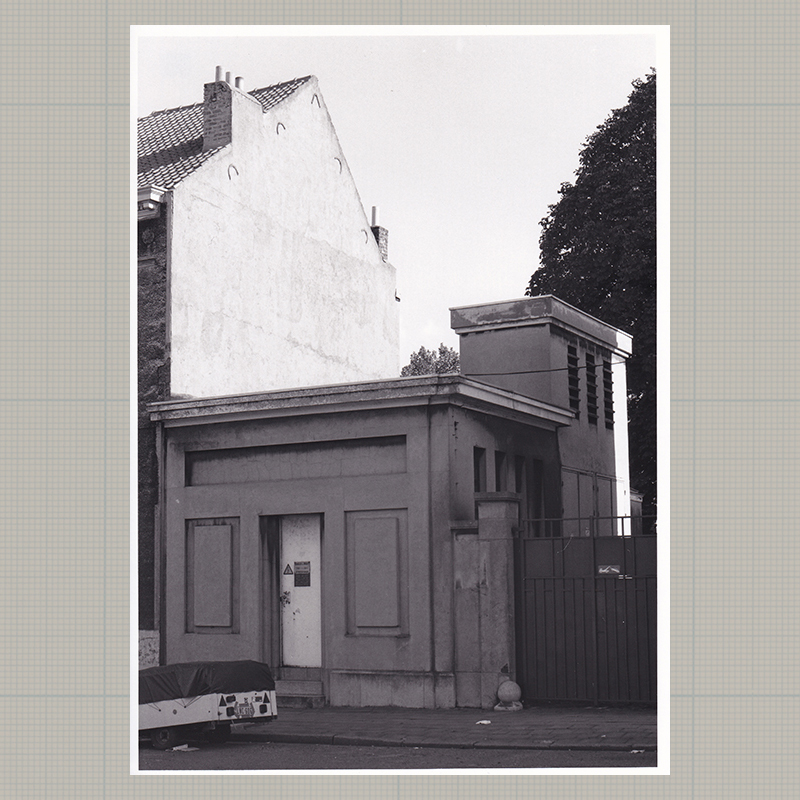
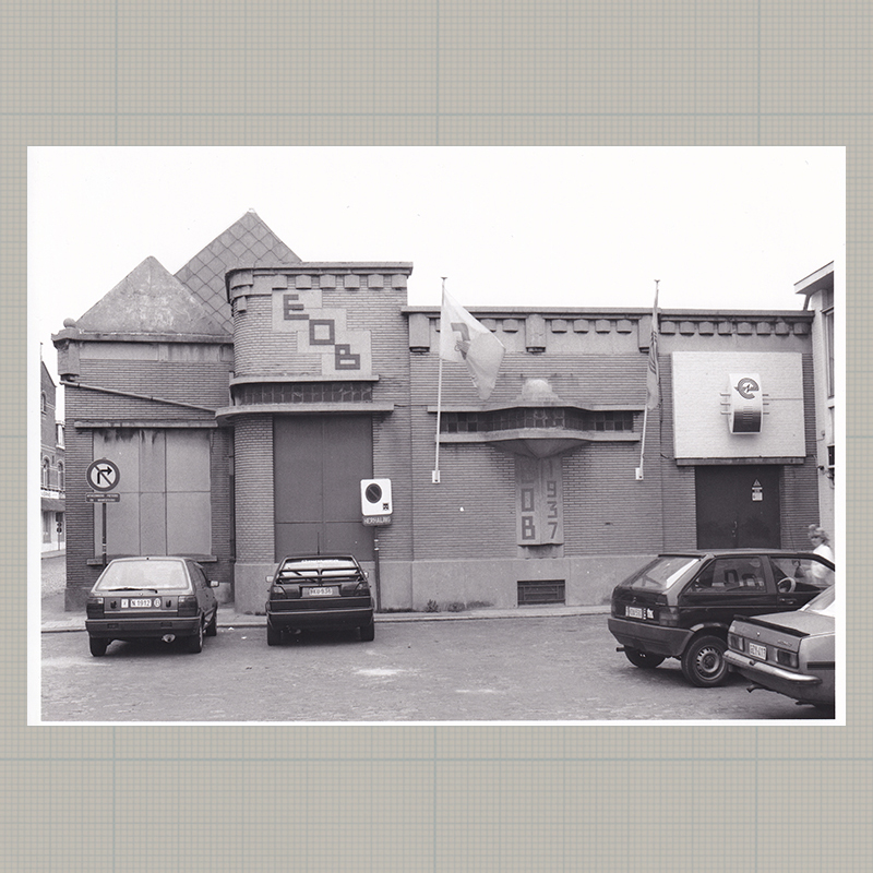
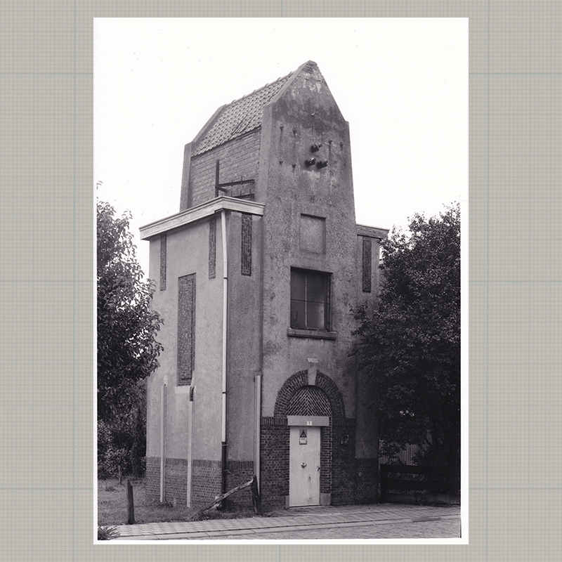
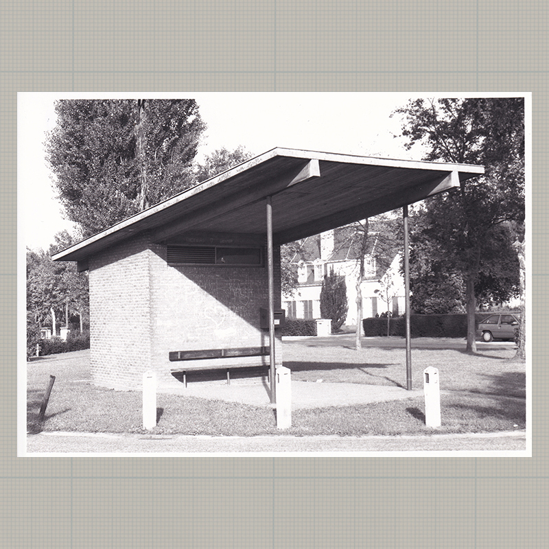
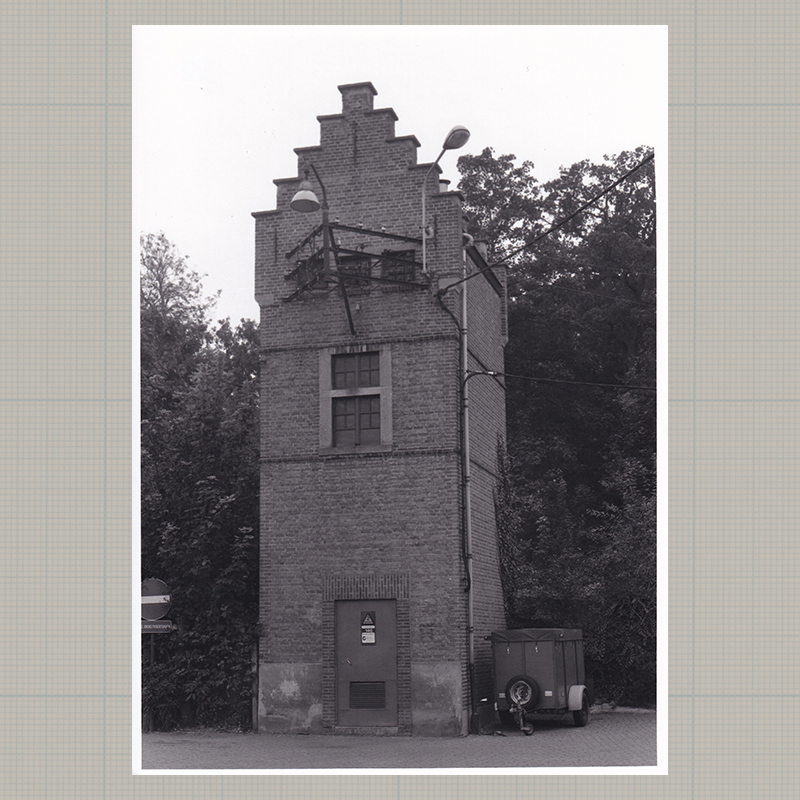
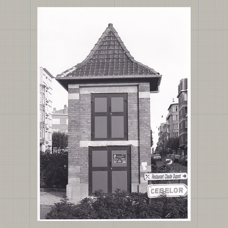
02 | Oostende | 51°12'35.0" N 2°57'44.8"E
-
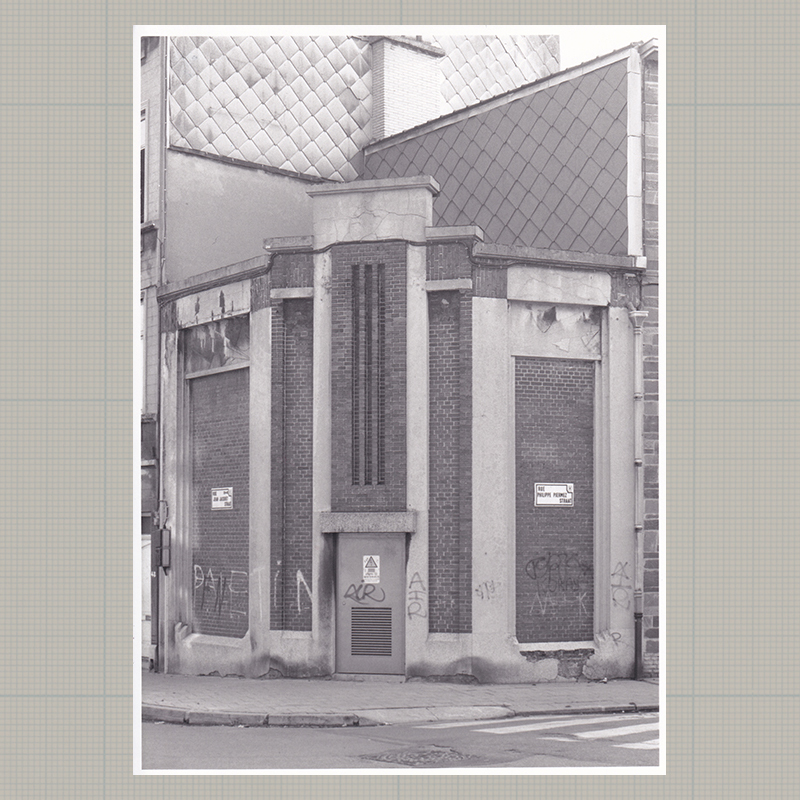
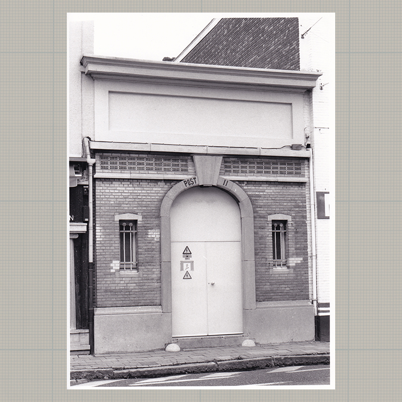
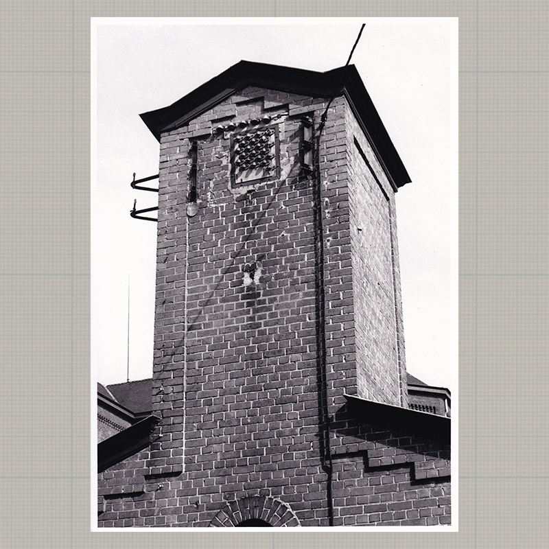
02 | Oostende | 51°12'35.0" N 2°57'44.8"E (detail)

-
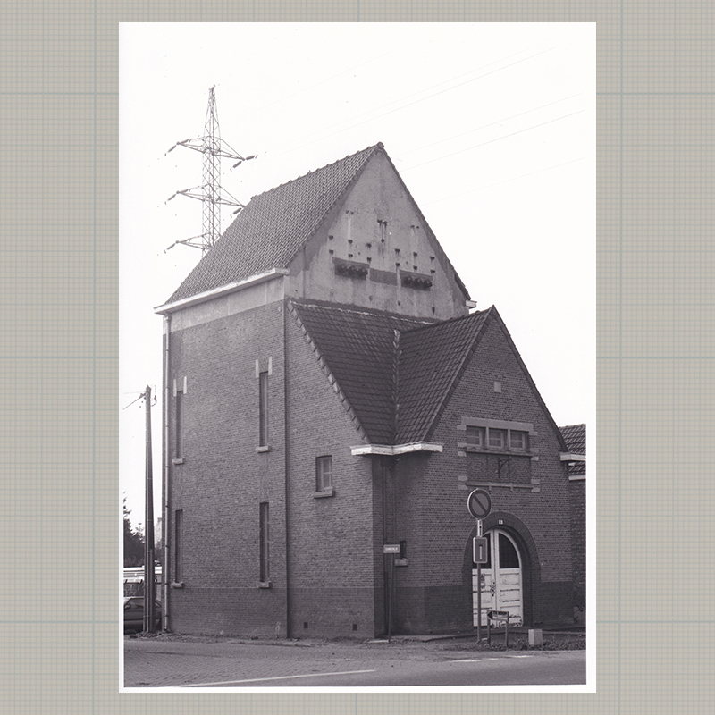
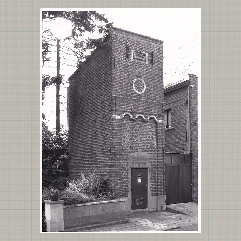
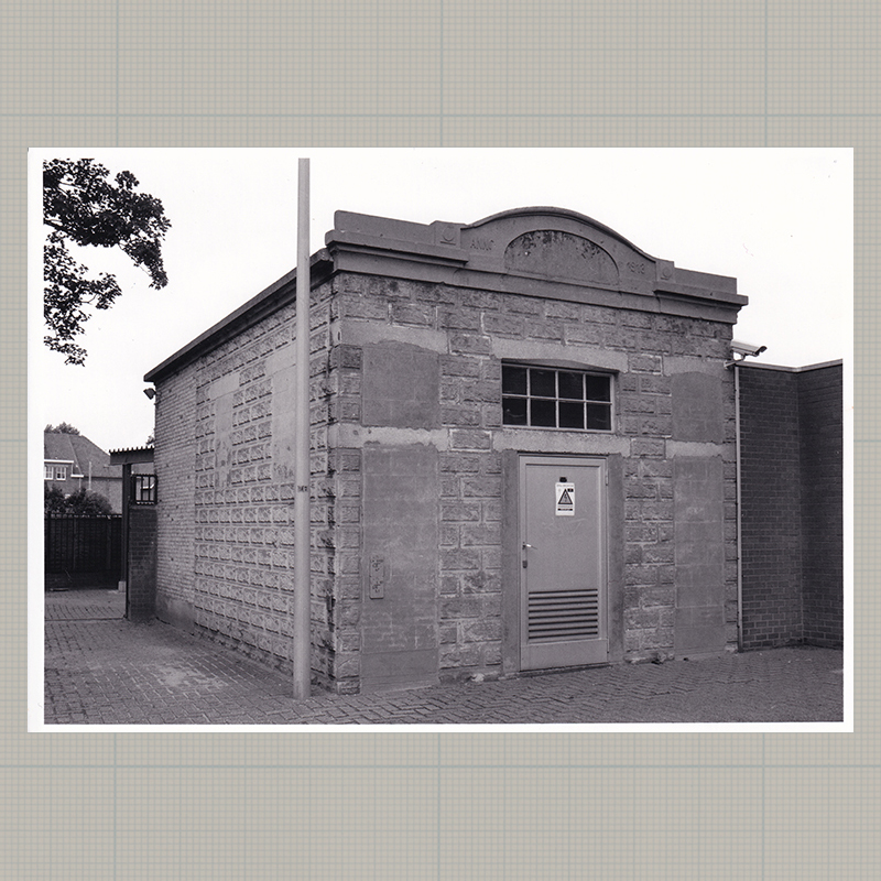
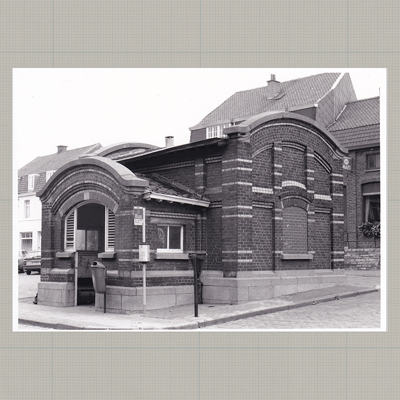
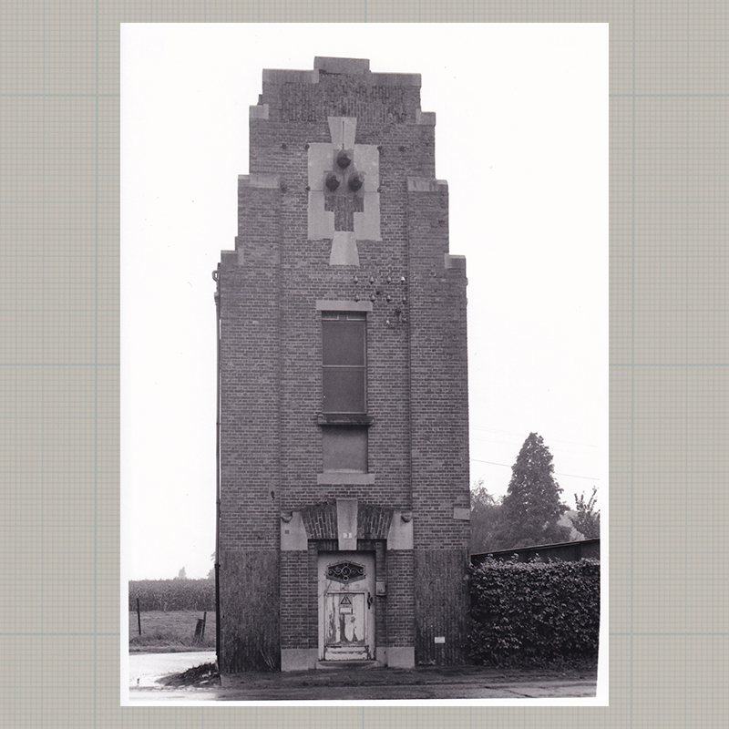
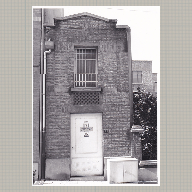
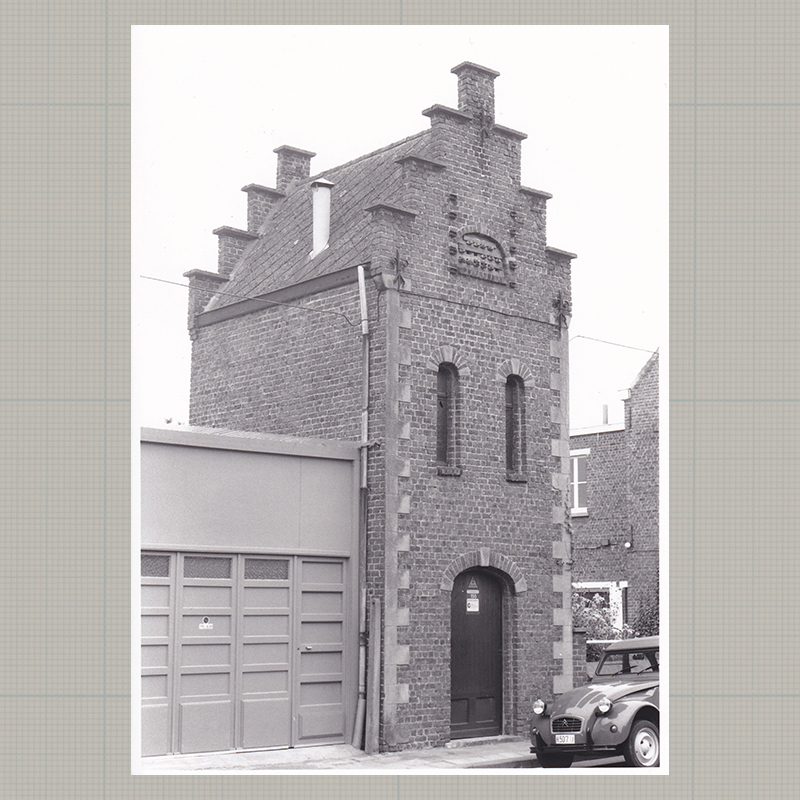
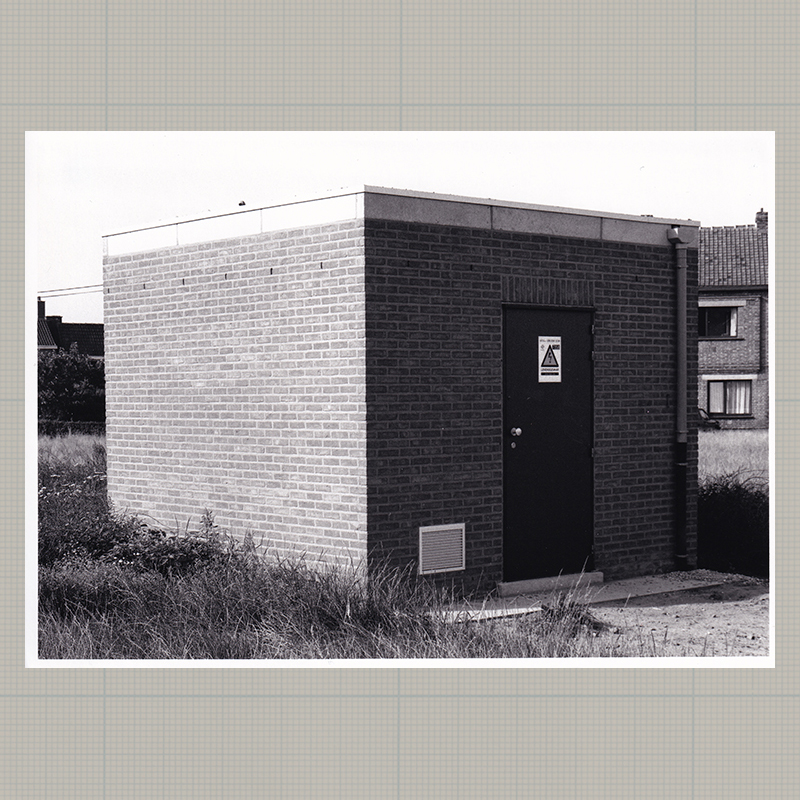
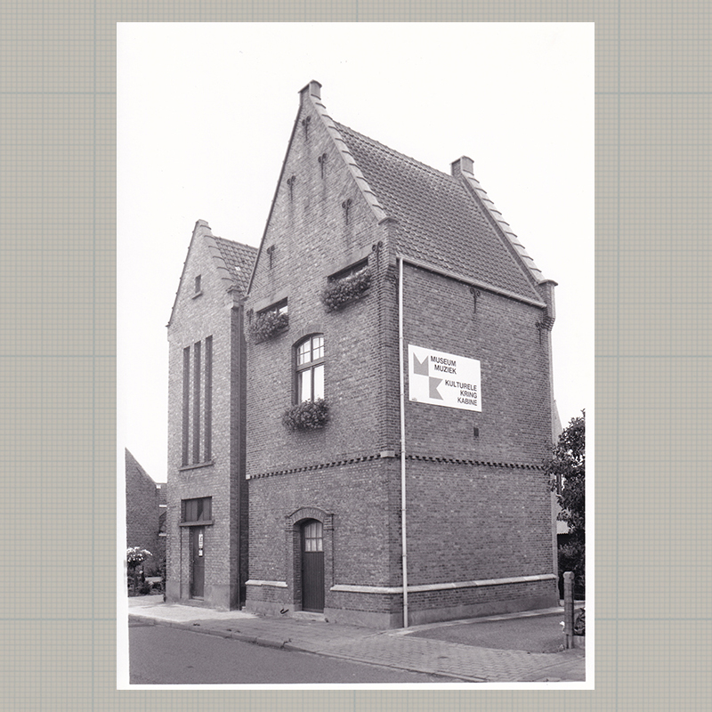
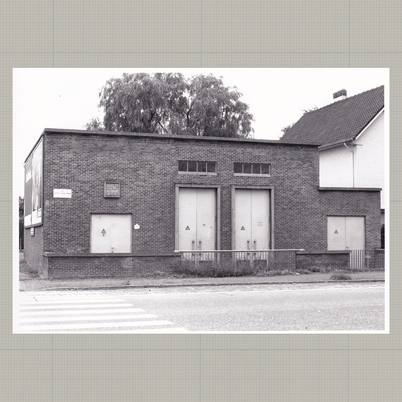
03 | Brecht | 51°18'16.8" N 4°34'09.0"E
-
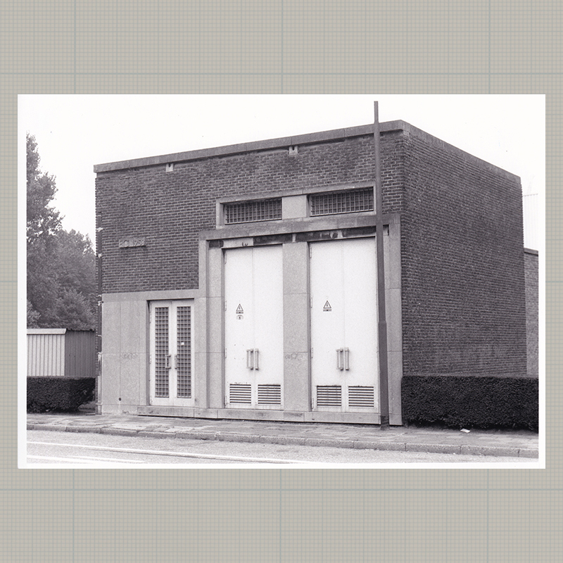
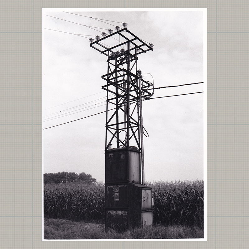
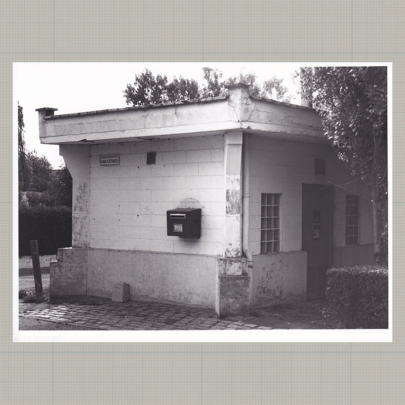
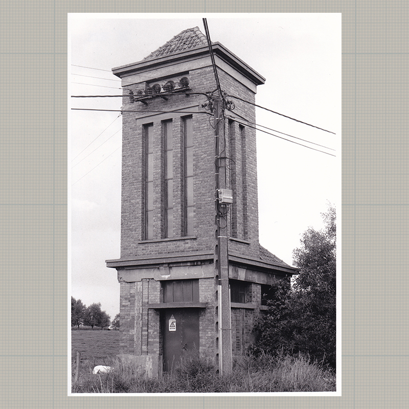
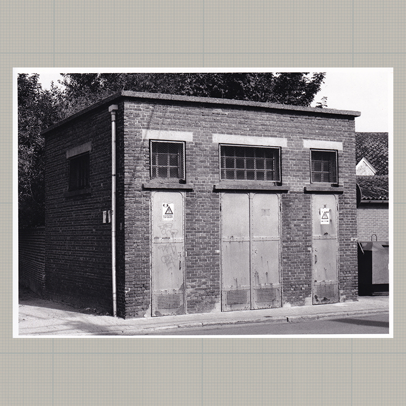
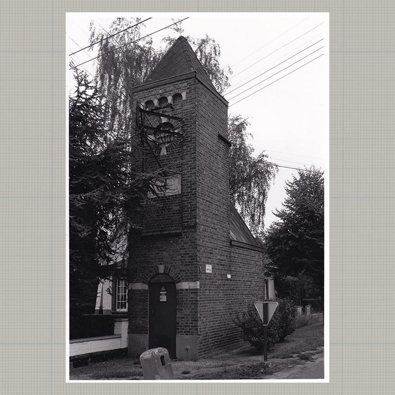
04 | Gent | 51°05'10.0" N 3°43'48.1"E
-
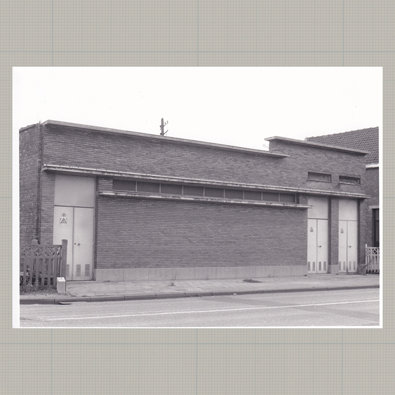
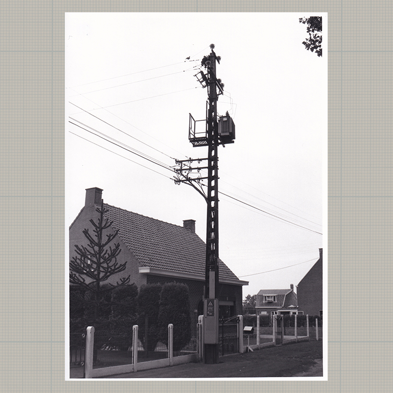
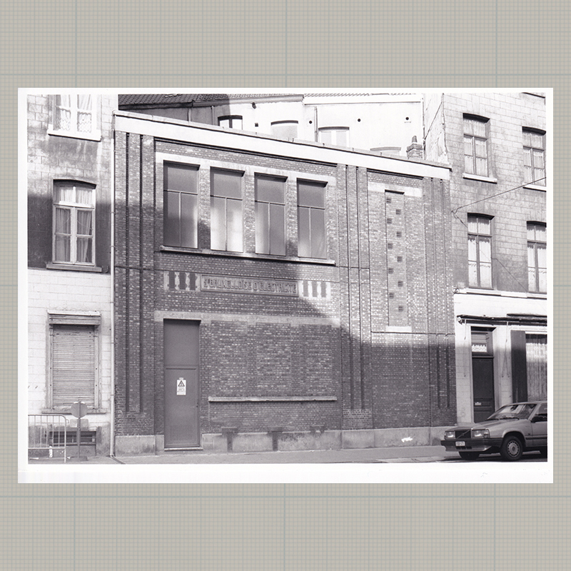
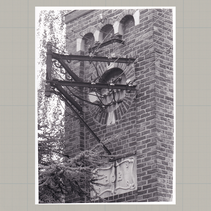
05 | Gent | 51°04'29.5" N 3°44'03.3"E
-
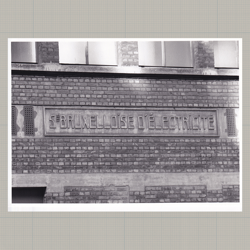
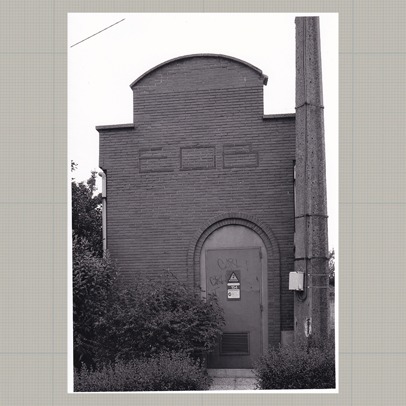
06 | Gent | 51°04'12.2" N 3°44'16.4"E
-
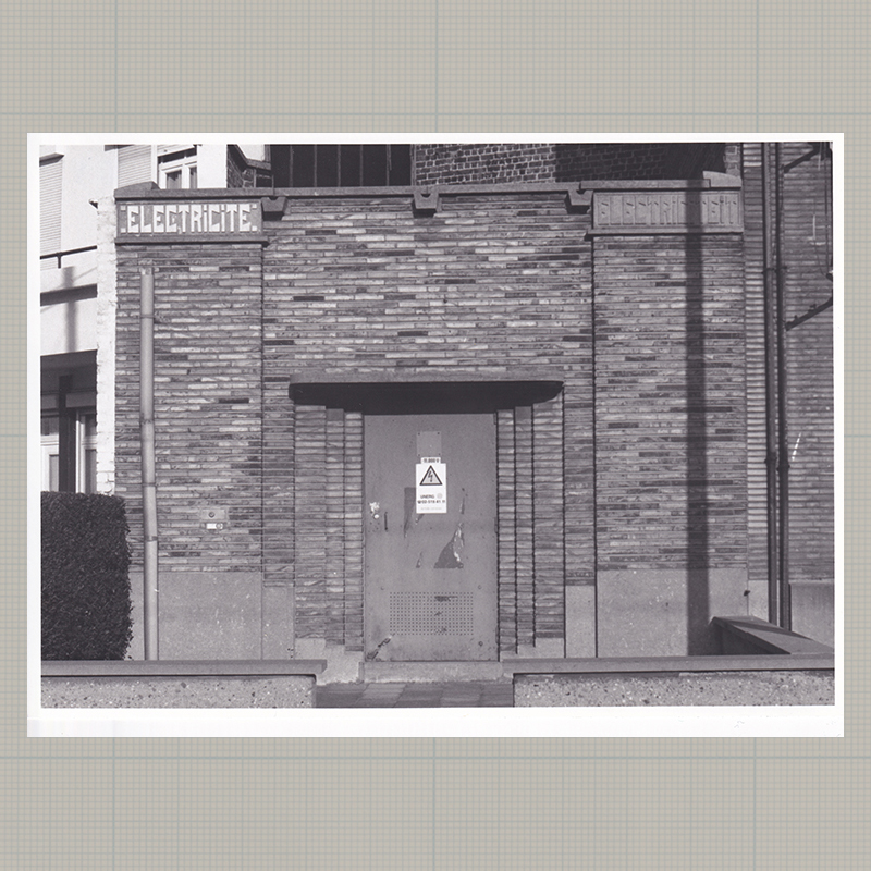
07 | Dikkelvenne | 50°55'06.8" N 3°41'19.6"E
-
08 | Nazareth | 50°56'26.1" N 3°37'20.4"E
-
09 | Deinze | 50°57'37.9" N 3°33'12.9"E
-
10 | Gottem | 50°57'48.8" N 3°27'36.9"E
-
11 | Dudzele | 51°16'10.9" N 3°12'42.5"E
-
11 | Dudzele | 51°16'10.9" N 3°12'42.5"E (detail)
-
12 | Zandvoorde | 51°12'05.7" N 2°58'23.7"E
-
13 | Oudenburg | 51°11'14.4" N 2°59'39.5"E
-
14 | Aartrijke | 51°07'39.8" N 3°01'45.1"E

-
15 | Wuustwezel | 51°22'51.0" N 4°33'36.9"E
-
16 | Ronse | 50°44'36.7" N 3°36'47.2"E
-
17 | Sint-Jans-Molenbeek | 50°51'38.6" N 4°20'31.8"E
-
18 | Ronse | 50°44'59.5" N 3°35'51.4"E
-
19 | Anderlecht | 50°49'37.1" N 4°18'02.1"E
-
20 | Sint-Jans-Molenbeek | 50°51'27.2" N 4°19'40.2"E
-
21 | Evergem | 51°06'29.5" N 3°42'21.9"E
-
22 | Evergem | 51°08'40.5" N 3°46'36.6"E

-
23 | Wondelgem | 51°05'25.5" N 3°42'55.4"E
-
24 | unknown address

-
25 | Sint-Truiden | 50°48'46.0" N 5°11'07.7"E
-
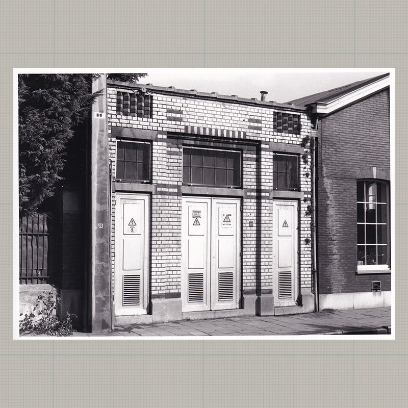
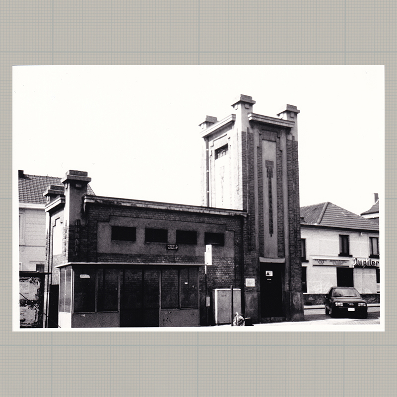
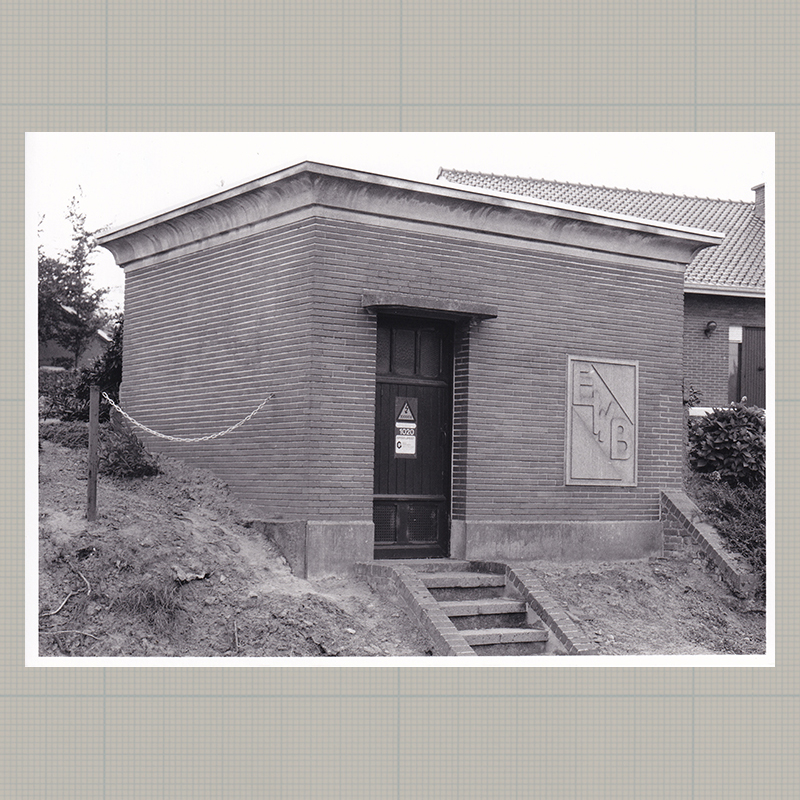
26 | Anderlecht | 50°50'37.6" N 4°18'44.2"E
-
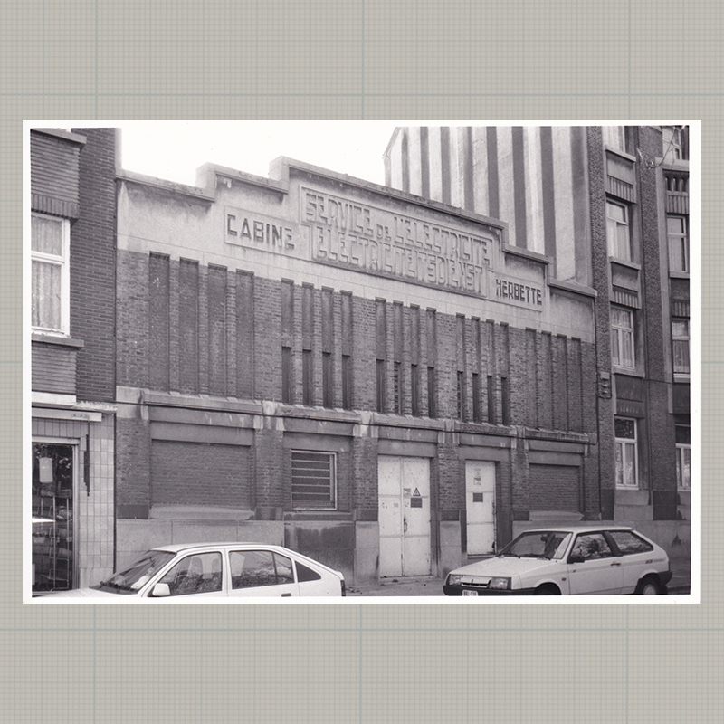
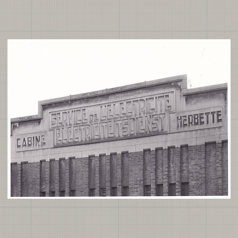
26 | Anderlecht | 50°50'37.6" N 4°18'44.2"E (detail)
-
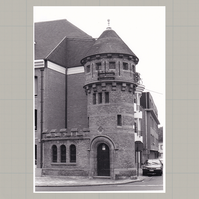
27 | Schaarbeek | 50°52'16.6" N 4°22'36.1"E
-
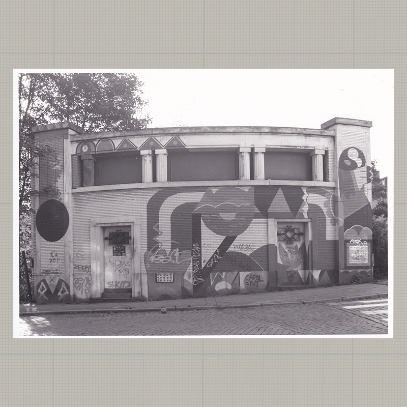
28 | Oudenaarde | 50°50'41.4" N 3°36'26.2"E
-
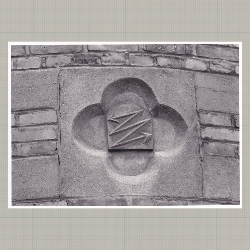
28 | Oudenaarde | 50°50'41.4" N 3°36'26.2"E (detail)
-
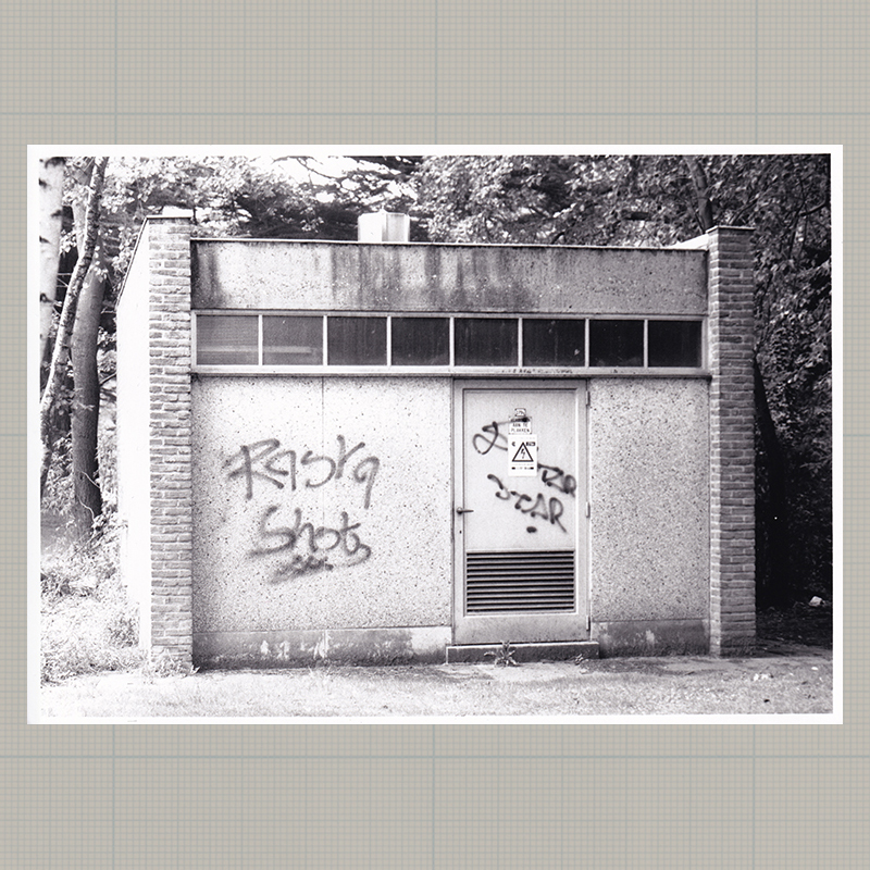
29 | unknown address
-
30 | Anderlecht | 50°50'24.9" N 4°18'56.3"E

-
31 | Sint-Amandsberg | 51°04'03.5" N 3°45'39.2"E
-
32 | Deinze | 50°58'42.2" N 3°31'55.6"E
-
33 | Ronse | 50°44'54.8" N 3°36'16.4"E
-
34 | De Haan | 51°16'21.7" N 3°01'54.0"E

-
35 | Wenduine | 51°18'32.7" N 3°06'46.3"E
-
36 | Nieuwmunster | 51°16'04.4" N 3°06'25.7"E
-
37 | Wuustwezel | 51°23'48.7" N 4°38'38.3"E
-
38 | Kalmthout | 51°23'39.3" N 4°28'40.0"E
-
39 | Kapellen | 51°17'32.5" N 4°26'38.5"E
-
41 | Brecht | 51°21'22.1" N 4°37'31.5"E
-
42 | Gent | 51°04'41.1" N 3°43'48.0"E
-
43 | Jette | 50°52'34.7" N 4°20'16.5"E
-
44 | Jette | 50°52'38.2" N 4°19'33.4"E
-
45 | Sint-Denijs-Westrem | 51°00'49.6" N 3°40'20.4"E
-
45 | Sint-Denijs-Westrem | 51°00'49.6" N 3°40'20.4"E (front)
-
46 | Nazareth | 50°57'31.2" N 3°35'51.0"E

-
46 | Nazareth |50°57'31.2" N 3°35'51.0"E (detail)
-
47 | Vorst | 50°49'23.8" N 4°19'50.5"E
-
48 | Ukkel | 50°48'51.1" N 4°20'50.7"E
-
49 | Oudenaarde | 50°50'52.9" N 3°36'25.4"E
-
50 | Oudenaarde | 50°51'03.6" N 3°35'42.4"E
-
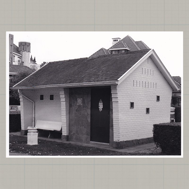
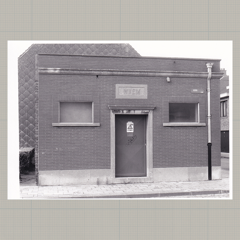
51 | Aartrijke | 51°06'00.9" N 3°06'16.8"E

-
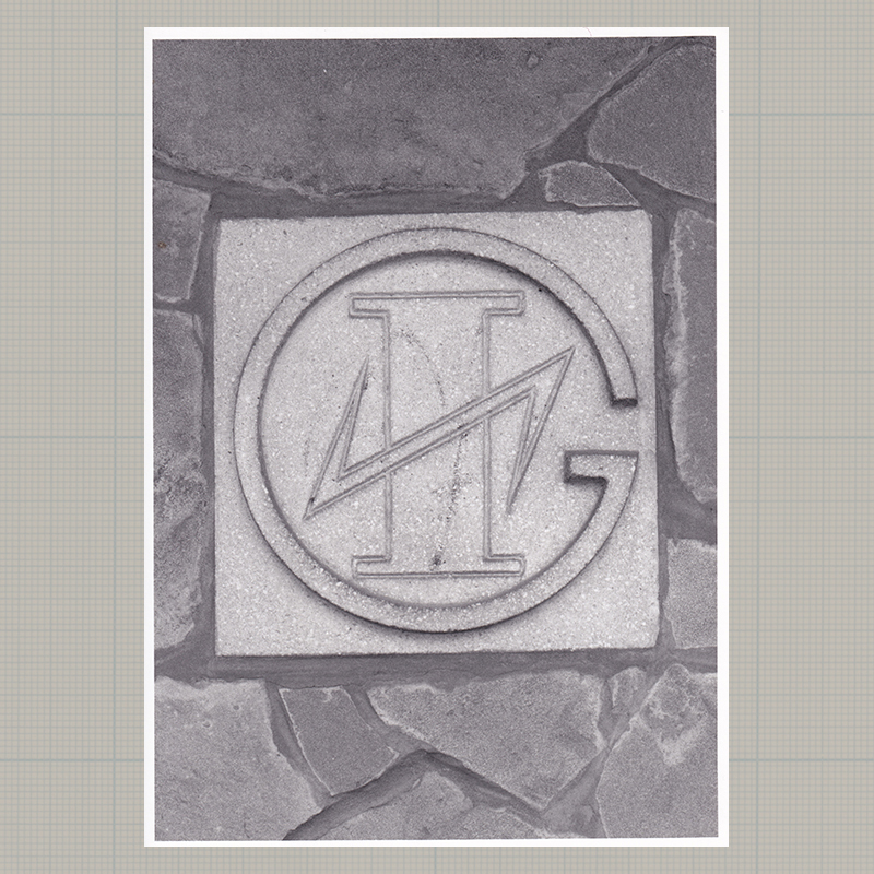
51 | Aartrijke | 51°06'00.9" N 3°06'16.8"E (bis)
-
52 | Schoten | 51°14'43.5" N 4°28'09.5"E
-
53 | Koekelberg | 50°52'03.6" N 4°19'12.6"E
-
54 | Deurle | 51°00'00.9" N 3°36'18.9"E

-
55 | Sint-Martens-Latem | 51°01'53.3" N 3°39'57.5"E
-
56 | Schelderode | 50°58'13.9" N 3°42'50.3"E
-
57 | Blankenberge | 51°18'29.0" N 3°06'58.1"E

-
58 | Sint-Agatha-Berchem | 50°52'06.9" N 4°18'11.8"E
-
59 | Anderlecht | 50°50'24.2" N 4°18'19.4"E
-
60 | Aarschot | 50°58'53.2" N 4°50'05.2"E
-
61 | Astene | 50°59'00.5" N 3°33'38.6"E

-
62 | Blankenberge | 51°18'49.5" N 3°07'40.3"E
-
63 | Lede | 50°57'29.1" N 3°57'59.3"E
-
64 | De Haan | 51°16'40.2" N 3°02'10.4"E
-
64 | De Haan | 51°16'40.2" N 3°02'10.4"E (front)
-
65 | Oostende | 51°13'26.4" N 2°56'31.4"E
-
66 | Aartrijke | 51°07'08.1" N 3°05'21.8"E
-
67 | Sint-Jans-Molenbeek | 50°51'31.8" N 4°20'33.9"E

-
68 | Sint-Jans-Molenbeek | 50°51'06.8" N 4°19'49.1"E
-
68 | Sint-Jans-Molenbeek | 50°51'06.8" N 4°19'49.1"E (detail)
-
69 | Sint-Agatha-Berchem | 50°52'10.6" N 4°17'31.6"E
-
71 | Semmerszake | 50°56'49.7" N 3°40'08.5"E

-
72 | Sint-Amandsberg | 51°03'40.7" N 3°45'35.5"E
-
73 | Deinze | 50°59'07.8" N 3°31'51.6"E

-
74 | Deinze | 50°58'52.9" N 3°32'52.9"E
-
74 | Deinze | 50°58'52.9" N 3°32'52.9"E (detail)
-
75 | Grammene | 50°58'34.6" N 3°28'19.2"E
-
76 | Ooike | 50°52'29.2" N 3°33'23.0"E
-
77 | De Haan | 51°16'27.4" N 3°01'44.8"E
-
77 | De Haan | 51°16'27.4" N 3°01'44.8"E (detail)
-
78 | Oostende | 51°12'53.7" N 2°56'06.1"E
-
79 | Heikruis | 50°44'05.4" N 4°06'43.5"E

-
79 | Heikruis | 50°44'05.4" N 4°06'43.5"E (detail)
-
80 | unknown address